


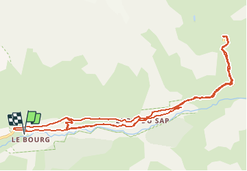
Les bouleaux / Refuge Giobernet

mthomas30
User

Length
15.3 km

Max alt
1642 m

Uphill gradient
667 m
Km-Effort
24 km

Min alt
1168 m

Downhill gradient
668 m
Boucle
Yes
Creation date :
2020-08-05 08:24:56.341
Updated on :
2020-08-23 20:07:28.317
1h57
Difficulty : Difficult

FREE GPS app for hiking
 SityTrail
IGN / Geographical institutes
SityTrail Plus
The world is yours!
About
Trail Mountain bike of 15.3 km to be discovered at Provence-Alpes-Côte d'Azur, Hautes-Alpes, La Chapelle-en-Valgaudémar. This trail is proposed by mthomas30.
Positioning
Country:
France
Region :
Provence-Alpes-Côte d'Azur
Department/Province :
Hautes-Alpes
Municipality :
La Chapelle-en-Valgaudémar
Location:
Unknown
Start:(Dec)
Start:(UTM)
281114 ; 4967173 (32T) N.
Comments